The Jakarta Post
Please Update your browser
Your browser is out of date, and may not be compatible with our website. A list of the most popular web browsers can be found below.
Just click on the icons to get to the download page.


Popular Reads
Top Results
No results found. Please check your search term and try again
Can't find what you're looking for?
View all search results
Popular Reads
Top Results
No results found. Please check your search term and try again
Can't find what you're looking for?
View all search resultsAnak Krakatau’s eruption begins a new soil story
Satellite imagery reveals a dramatic shift on Sertung Island following Anak Krakatau’s eruption. As lush greenery turns to ash, a new natural laboratory emerges for studying the birth of soil.
Change text size
Gift Premium Articles
to Anyone
Share the best of The Jakarta Post with friends, family, or colleagues. As a subscriber, you can gift 3 to 5 articles each month that anyone can read—no subscription needed!
 Set as preferred source
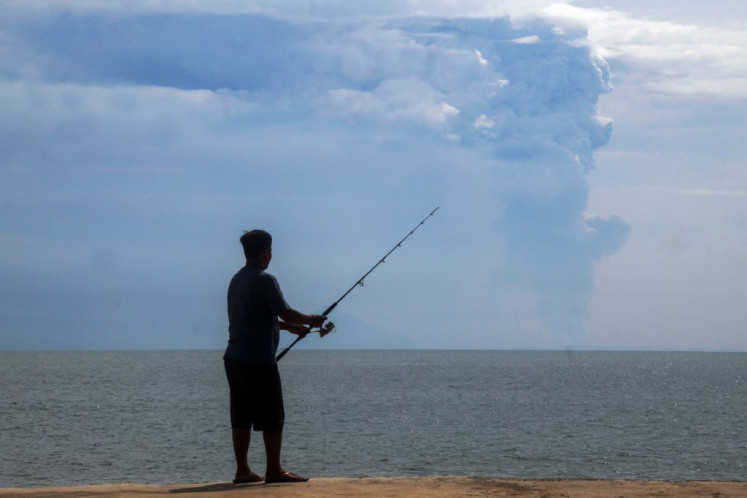
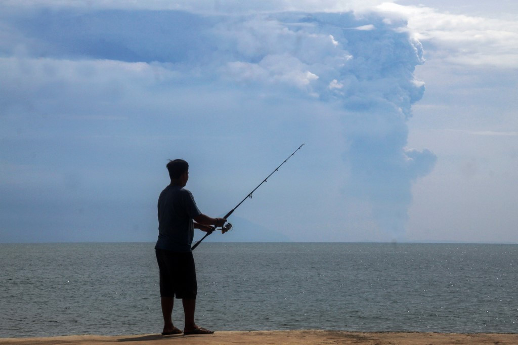 A man fishes at Pasauran beach, Anyer in Serang, Bantedn, on April 24, 2022 while Mount Anak Krakatau spews thick smoke into the air. (AFP/Dziki Okotomulyadi)
T
he eruption of the Anak Krakatau volcano earlier this month reached far beyond the ground rumble and the ash blanketing nearby areas.
Hundreds of kilometers above Earth, satellite imagery from Sentinel-2 let us watch how the surface of the Anak Krakatau archipelago transformed after the blast.
The most dramatic transformation occurred on Sertung Island, just west of Anak Krakatau.
On Aug. 8, much of the island appeared green and densely vegetated. When the Sentinel-2 satellite passed over the area again on Sept. 8, most of that green signature had disappeared. A chunk of the area instead appeared grey to brown, as if the island had lost its life in barely a month.
But satellite images do not simply tell us whether plants are alive or dead. They record how the Earth’s surface reflects different wavelengths of light. The abrupt change on Sertung therefore sparks a series of questions.
For soil scientists, this transformation adds to the puzzle: are the plants dead or merely buried under ash? How much debris actually landed? And what happens to this fresh volcanic material next?

Remote sensing lets scientists examine vegetation, moisture, soil, rock and volcanic deposits in ways that are not obvious from ordinary photographs.
One of the most widely used measures is the Normalized Difference Vegetation Index (NDVI). By measuring how green leaves reflect red and near-infrared light, it reveals both the presence and health of plant life on the ground.
Before the eruption, vegetated parts of Sertung had an average NDVI of about 0.72, representing a strong vegetation signal. By Sept. 8, that signal had fallen to around zero.
The change is substantial. Yet a lower vegetation score does not automatically mean the plants are dead. A fresh layer of ash, fallen leaves, physical damage from heavy debris, buried plants or even atmospheric conditions can produce the same satellite readings.
The NDVI therefore tells us that the surface changed dramatically. It does not, by itself, tell us exactly how many plants survived. That requires observations on the ground.
We therefore looked at other parts of the satellite spectrum.
Shortwave infrared (SWIR) wavelengths are particularly useful because they can provide extra detail on plant moisture levels and the physical makeup of surface materials.
Before the eruption, Sertung showed the spectral characteristics expected from a strongly vegetated island. After the eruption, much of the surface shifted toward the response expected from non-vegetated material.
A second index, the Normalized Difference Moisture Index (NDMI) showed the same general pattern. The vegetation-associated moisture signal declined sharply.
Taken together, these four distinct data sets, true-color imagery, vegetation scores, SWIR response and moisture levels, paint a consistent picture: Sertung Island’s surface underwent a profound transformation after the eruption.
Interestingly, Panjang Island, just east of Anak Krakatau, retained a much stronger green signal. This is striking given how badly Panjang was battered during the major 2018 eruption.
The contrast between two islands only a few kilometers apart shows just how uneven volcanic destruction can be. Eruption debris rarely falls symmetrically. Where ash settles depends on wind direction, plume height and particle size.
Satellite data show the ash plume blew heavily west and southwest toward Sertung, sparing Panjang the worst of it.
This sharp divide between neighboring islands gives scientists a rare chance to see how wind patterns and ashfall shape ecosystem survival.
Satellites can show us where the surface changed. Yet, they cannot tell us everything about the material that caused the change. For that, we need samples and laboratory testing.
Laboratory chemical analyses can determine which elements are present and in what concentrations. Mineralogical analyses can identify the minerals and volcanic glass that make up the newly deposited material.
These properties matter because they influence what happens next. Once volcanic material is exposed at the surface, rainwater begins reacting with minerals and glass. Some components dissolve. Chemical elements are released. Surfaces become altered.
Life also begins.
Microorganisms colonize the deposits. Plant residues trapped beneath or mixed into the ash begin to decompose. Pioneer plants establish themselves where conditions allow. Roots, microbes, rainfall and organic matter progressively transform what began as fresh volcanic debris.
This is how geological material starts becoming biological material. Given enough time, eruption products can become the parent material from which new soils develop.
Very few places on the planet let us watch this unfold as clearly as Krakatau.
Anak Krakatau emerged permanently above sea level in 1930, decades after the catastrophic 1883 eruption destroyed much of the former Krakatau Island.
Since then, scientists have observed repeated cycles of volcanic construction, eruption, erosion, vegetation colonization and ecological recovery.
Every eruption effectively resets part of the landscape.
Sertung offers a particularly interesting case because it was already well vegetated before the September 2026 eruption. Fresh volcanic debris did not land on a barren volcanic cone, but directly onto an established island ecosystem.
That raises several questions we can follow over time.
Will the vegetation reappear rapidly once rainfall washes ash from surviving leaves? Are some areas buried under deposits thick enough to prevent rapid recovery? Will erosion redistribute the new material before plants can recolonize it? And how long will it take before satellites once again record a strong green signal?
The next satellite image may answer some of these questions. Others may take years.
Studying active volcanoes once depended heavily on researchers entering difficult and sometimes dangerous terrain.
We can now begin the investigation from hundreds of kilometers above Earth.
Satellites can reveal where environmental change has occurred and how rapidly the landscape responds. Field observations can determine what has survived. Laboratory measurements can tell us what the new material is made of. Soil science can explain what happens as that material interacts with water, organisms and time.
Sertung Island has changed dramatically within a matter of weeks. But from a soil scientist’s perspective, the eruption is not just a story of destruction.
It is also the beginning of another experiment in soil formation. What now appears to be volcanic ash and debris may eventually become part of the soil supporting the island’s life.
By continuing to watch Sertung from space, and eventually returning to study it on the ground, we have a rare opportunity to observe that transformation almost from the moment it begins.
---
 Dian Fiantis is a professor of soil science at Andalas University. Budiman Minasny is a professor in soil-landscape modeling at University of Sydney. Frisa Irawan Ginting and Rudiyanto contributed to the article. This article is republished under a Creative Commons license.